PRODUCTS
Local Gradient Data Products
Property data and mapping services delivered via API and bulk data download
Property Boundary Tile Server API
Property parcel boundary map layer delivered via easy to use API as vector or raster tiles
Parcel Data API - Coming Soon
Standardized nationwide parcel feature data delivered via API
Bulk Parcel Data
National and state level standardized parcel data delivered via bulk data download
Custom Solutions
Don't see a product that meets your needs, contact us
Bulk Parcel Data
Standardized Parcel Data Bulk Download
Data Description GuideNational or State level standardized parcel attribute and boundary data delivered via bulk data download.
Data delivered in tabular format in .geojson, .kml, .sqlite3 and .csv. Standardized data formats and column names. Includes perpetual license to use data and free update downloads for 12 months.
Available States
Alaska, Alabama, Arkansas, Arizona, California, Colorado, Connecticut, District of Columbia, Delaware, Florida, Georgia, Hawaii, Iowa, Idaho, Illinois, Indiana, Kansas, Kentucky, Lousiana, Massachusetts, Maryland, Maine, Michigan, Minnesota, Missouri, Mississippi, Montana, North Carolina, North Dakota, Nebraska , New Hampshire , New Jersey , New Mexico , Nevada, New York, Ohio, Oklahoma, Oregon, Pennsylvania, Rhode Island Statwide, South Carolina, South Dakota, Tennessee, Texas, Utah, Virginia, Vermont, Washington, Wisconsin, West Virginia, WyomingDEMO MAP
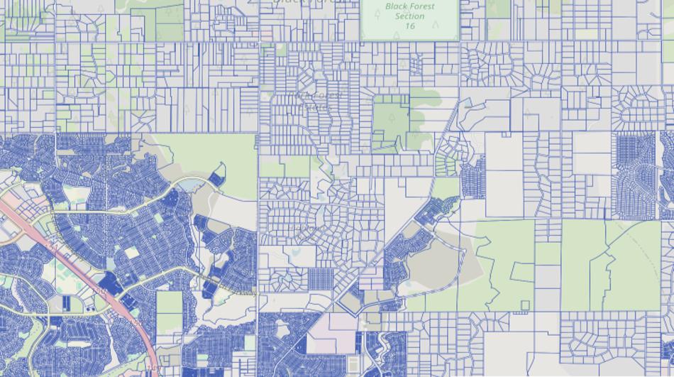
Parcel Boundary Tile Server API - Demo Map
API Connection GuideNationwide parcel boundary mapping data with over 97% coverage by population.
Tiles served in either raster or vector form. Delivered via easy to use API compatible with the most popular mapping applications, including Leaflet, MapBox, and many others. Data is regularly updated from thousands of originating sources.

Flexible Options
Property Boundary Tile Server API
Trial Credits
Development
Property boundary tile server credits for testing and development
- All Parcel Boundary Data
- 10,000 Tiles
- Customer Support
- Replenish Credits As Needed
- ...
- ...
Standard
Production
National level parcel boundary raster and vector tiles
- All Parcel Boundary Data
- 300,000 Tiles/Month
- Additional Tiles $0.001 Each
- Optional Hard Limit on Tiles
- Customer Support
- No Commitment Cancel Anytime
Custom
Custom solutions for any business
Contact us to develop a custom solution for your needs
- All Parcel Boundary Data
- Custom Styles and Themes
- Custom Tile Limits
- Access to Developers
- Customer Support
- ...
